BAYOU VERMILION PRESERVATION ASSOCIATION
  • Home
  • Programming
    • Reviving Resilient Landscapes >
      • 1. Leonville Boat Launch Bankline Stabilization
      • 2. Nature Station Trail Bridge
      • 3. Acadiana Park Walking Track
      • 4. Freetown Heritage Park
      • 5. Neyland Park Urban Planting
      • 6. Park Des Ponts Breaux Bridge
      • 7. City Park Pond New Iberia
      • 8. Palmetto Island Bank Stabilization
    • Symposium >
      • Symposium Programs
    • Painted Rain Barrel Contest
    • Vermilion River Alliance (VRA)
    • Water Quality Sampling Program
  • Resources
    • Resources for Teachers
    • Maps
    • Water Basics
  • About
    • Board
    • Events >
      • Appreciation of Watershed Heritage by Ray Brassieur
    • History >
      • Photos
  • STORE
  • Join
  • Calendar/News
  • Contact
    • What Can I Do?

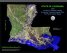
Our Watershed - Teche-Vermilion Watershed

Click here to read about our watershed on the Bayou Vermilion District's website;

What is a Watershed?

A watershed is an area of land over which all water flows to a common body of water such as a lake or pond. We all live in a watershed or drainage basin.  Watersheds can be as large as the Mississippi River drainage basin or as
small as a farm with a pond. Your watershed may be made up of mountains, farms, houses, businesses, or towns.
More

Watershed Facts

Freshwater ecosystems cover less than one percent of the Earth’s surface, but are home to 35 percent of all vertebrate species. Global extinction rates for freshwater species are four to six times higher than those for terrestrial or marine species.  In the United States nearly half of the 573 animals on the threatened and endangered list are freshwater species.Forty percent of all fish species in North America are at risk or extinction.More

Vermilion Watershed

Picture
Click Here to read Vermilion Watershed Poster

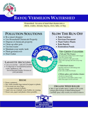
Non-Point Water Pollution and Watershed Planning

Picture
Click Here Understanding TMDLs and Watershed Planning and Implementation
 A Total Maximum Daily Load (TMDL) is a regulatory term in the U.S. Clean Water Act, describing a value of the maximum amount of a pollutant that a body of water can receive while still meeting water quality standards

2008 Bayou Vermilion River Conference

Picture
Click here for Program Guide for
2008 Bayou Vermilion River Conference

Powered by Create your own unique website with customizable templates.
  • Home
  • Programming
    • Reviving Resilient Landscapes >
      • 1. Leonville Boat Launch Bankline Stabilization
      • 2. Nature Station Trail Bridge
      • 3. Acadiana Park Walking Track
      • 4. Freetown Heritage Park
      • 5. Neyland Park Urban Planting
      • 6. Park Des Ponts Breaux Bridge
      • 7. City Park Pond New Iberia
      • 8. Palmetto Island Bank Stabilization
    • Symposium >
      • Symposium Programs
    • Painted Rain Barrel Contest
    • Vermilion River Alliance (VRA)
    • Water Quality Sampling Program
  • Resources
    • Resources for Teachers
    • Maps
    • Water Basics
  • About
    • Board
    • Events >
      • Appreciation of Watershed Heritage by Ray Brassieur
    • History >
      • Photos
  • STORE
  • Join
  • Calendar/News
  • Contact
    • What Can I Do?